

 Ambitious recovery programme launched as unprecedented decline in pearl mussel highlights fragile River Dee
 DeeWatch December
Why do we need natural flood management?
Natural Flood Management (NFM) involves techniques that work with the natural landscape to slow and store flood waters.
In the face of a changing climate, a catchment-based approach to flood management in Deeside has much to offer. What happens in one part of the river system has knock-on effects. For example, by building embankments and installing extensive drainage networks, we are speeding up flows that will affect the catchment downstream. Similarly, by taking steps to hold back flows in the upper catchment, we can help to reduce flooding further down the river system. By pooling resources and enhancing our land management practices, we can help to manage the flow of water better, and do this alongside existing land uses.
Environmental legislation such as the Floods Directive and Water Framework Directive are driving a move towards a more integrated, catchment-based approach to the management of land and water. In Scotland, the framework for delivering a more sustainable approach to flood risk management has been established in legislation under the Flood Risk Management (Scotland) Act 2009. Under this Act, SEPA is required to work with local authorities and other responsible authorities to identify the most sustainable actions to manage flood risk, and this includes NFM in some areas.
What are the benefits of natural flood management?
Slowing and storing the flow of water can help to:
- Reduce local flooding, erosion and run off
- Improve water quality
- Retain soil, seed and fertiliser
- Enhance habitats with knock-on benefits for biodiversity, carbon storage, recreation and health and wellbeing
Where the cost of traditional flood defences cannot be justified, such as in locations with a very small number of properties at risk, NFM can also be the most cost effective way for local communities to address flooding.
What is the role of the Dee Catchment Partnership?
The Dee Catchment Partnership is working to ascertain the best places to concentrate on installing NFM measures by developing maps that will show the opportunities where it could be effective. We aim to create fully-functioning demonstration sites where the techniques can be viewed, supported by information on design, construction, and costs. We are gathering expertise, resources and advice on how to connect these features in Deeside and offer help to co-ordinate their delivery.
NFM Measures
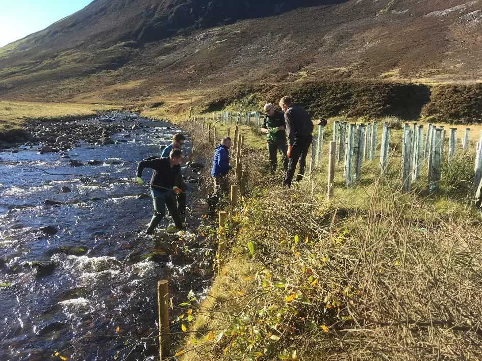
Creating woodlands to reduce soil erosion and runoff, provide shelter, improve soil strength and stability and increase infiltration. Trees can be targeted along the riparian edge creating a buffer strip, managed as wet woodlands or planted to reconnect streams to the floodplain.
Creating, restoring and managing wetlands to store more water. This can include wetlands, bogs and offline storage areas. This can be aided by promoting the growth, structure and species composition of vegetation on land by limiting and managing grazing. The water table could be raised through dams, sluices, ditch blocking or outlet control.
Restoring peatlands to reduce drainage, store carbon, increase water quality and enhance biodiversity. This can be achieved through drain blocking, stabilising bare peat and restoring vegetation cover.
Supporting rain gardens, green roofs and living walls to gather water, allowing vegetation to flourish in urban areas.
Promoting good soil practice to reduce runoff. This can be done in a number of ways including increasing organic matter, introducing continuous cover and crop rotations, installing sediment traps or field bunds, planting trees and reducing soil compaction, by modifying farming practices and reducing stock densities.
Designing swales, kerb planters, filter strips and rills to collect, move and clean surface water, before gathering in larger water bodies for storage.
Floodplain restoration to enable the temporary storage of flood waters. This can be achieved through removing barriers, using permeable surfaces.
Protection of riverbanks (installing buffer strips, bunds) to develop a buffer zone alongside watercourses.
Placing flow restrictors in the watercourse (large woody debris, leaky dams)
Protecting banks from excessive erosion (willow spilling)
Restoring the shape of the channel to a more natural course (re-meander, re-connect)
By using a combination of these techniques and traditional flood defence engineering throughout the river system, flows can be held back. This increases the overall capacity of the catchment and helps to reduce and delay flood peaks in both towns and countryside.
Further Information
SEPA – Natural Flood Management Handbook
Register for the NFM Network Scotland
Evidence Directory Summary document
Working with Natural Processes evidence base
CIRIA: Developing guidance on the delivery of NFM
A 60 second guide to hard engineering, A 60 second guide to soft engineering– Royal Geographical Society
- The North East Green Network has produced a summary of some of the project work carried out throughout the area in their Natural Flood Management Project, Gap Analysis Report.
- The River Dee Trust and board have been busy installing a number of large woody debris structures and live willow fencing along many of the upland streams in recent years.
- The current Dee and Don Riparian Habitat project (River Dee Trust) works with landowners and farmers, supporting them through SRDP funding to install riparian woodland, wet woodland, buffer strips and off stream waterings.
- The Dee Catchment Partnership is preparing a demonstration site in Tarland, displaying a series of leaky dams, large woody debris structures and field bunds.
- The Cairngorms National Park has their own Peatland Officer and is working with the Moorland Partnership group and local estates to deliver Peatland restoration, through the Peatland Action Fund.
- Aberdeenshire Council are working with the Dee Catchment Partnership to discuss proposals for NFM alongside the new Ballater Flood Scheme.
Catchment Models
We regularly take our flooding models to outreach events to raise awareness of beneficial land management practices. Click here to find out more.
DCP ‘Managing flooding naturally’ leaflet DCP ‘Flooding education sheet’ DCP ‘Flooding Models’