

 Ambitious recovery programme launched as unprecedented decline in pearl mussel highlights fragile River Dee
 DeeWatch December
Heavy rainfall across the catchment in recent weeks has meant frequent flood warnings and disruption for many. Aberdeen in particular, has experienced bouts of flash flooding, when fast-moving and unexpectedly high volumes of surface water have collected in parts of the city.
Towns and cities are especially vulnerable to flooding because of the increase in impermeable surfaces and higher populations present, as Susan Cooksley, Partnership Manager explains: “Since water can’t seep through roads, pavements or walkways, the volume of surface water builds during periods of sustained heavy rain, causing widespread issues – in Aberdeen we’ve seen damage to homes, shop closures, stranded cars and cancelled concerts. Development in towns and cities leads to the creation of more impermeable ground, so incorporating sustainable drainage systems – such as ponds, green roofs and wetlands – in any new development is an essential part of managing the area’s flood risk.”
Susan continues: “Protecting property and livelihoods is paramount, and this protection begins in the upper reaches of the river, where many measures such as tree planting and floodplain restoration can combine to slow flows. This so-called ‘Natural Flood Management’ can support traditional flood engineering by reducing and delaying flood peaks.”
While natural events are often the cause of flash flooding, it also occurs when flood defences or drainage systems fail, so keeping these clear is paramount. Aberdeen City Council began its annual leaf clearing activities last month, specifically targeting areas prone to flooding. With large mechanical sweepers as well as street-sweeping staff on the ground, drains and soakaway areas have been kept largely free of litter and leaves – in an operation that clears around eight times as much debris during autumn.
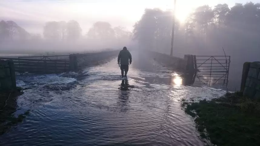
Flooded roads 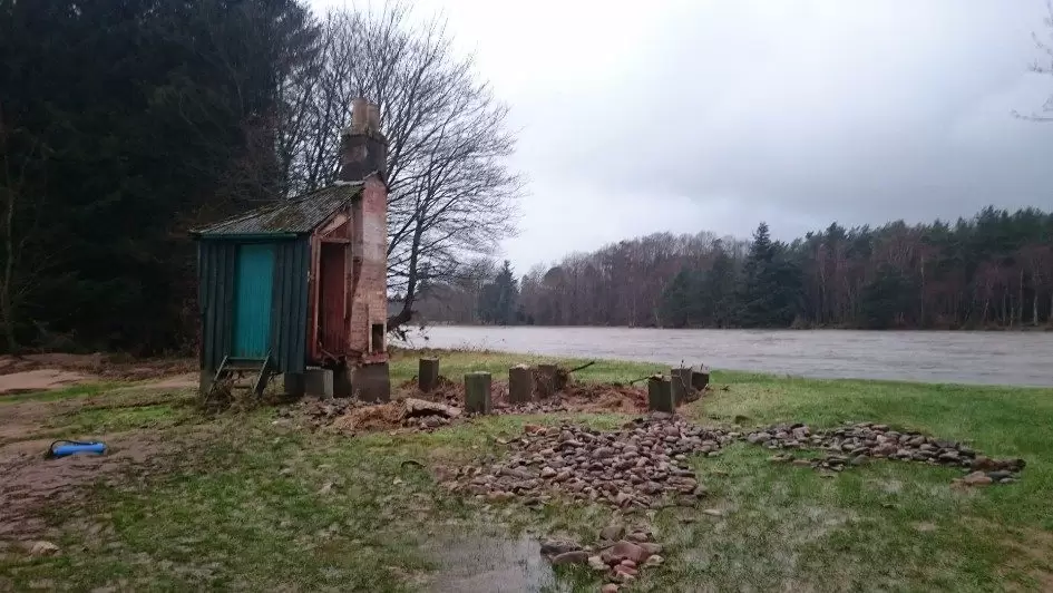
Flooding damage to fishing hut
Widespread flooding across Deeside following Storm Frank in December 2015, which brought a month’s worth of rainfall in a single day.
In the coming year, Aberdeenshire Council will be preparing plans to manage surface water across specific areas deemed vulnerable to flooding as identified in their 2016-2020 Flood Risk Management Plan for the region. There are several vulnerable areas in the Dee catchment, including parts of Aberdeen, Westhill, Peterculter, Banchory, Aboyne and Ballater. Flood Engineer for the Council, Lee Watson, explains:
“Comprising a combination of natural and artificial flood management schemes, the Flood Plan describes the actions required to avoid and reduce the risk of flooding and prepare and protect our communities within these vulnerable areas and across the region. The plan is the first of its kind for the north east of Scotland, and a testament to the fact that the collaborative efforts of public bodies can be brought together to deliver sustainable outcomes.
“But we can all play our part in managing flood risk – individuals themselves are the first line of defence against flooding. Simple steps such as clearing leaves from gutters and drains, getting your septic tank emptied and signing up for floodline alerts all make a difference.”
For more information about how you can prepare for flooding visit http://floodlinescotland.org.uk/.
ENDS
For media enquiries please contact:
Sally Wallis
07961 980152
013398 85436