

 Ambitious recovery programme launched as unprecedented decline in pearl mussel highlights fragile River Dee
 DeeWatch December

This project has produced a design to show how stream and wetland habitats in the Tarland Burn could be enhanced, to improve conditions for nature, increase carbon storage, and restore more natural flow conditions.
Background
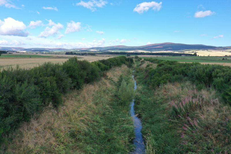
The area downstream of Tarland village (between the village and Coull bridge) is the site of one of Deeside’s great lost wetlands. This area would once have provided a rich variety of wildlife habitats, locked up large amounts of carbon, and helped to regulate stream flows by releasing water slowly during times of drought and flood. Over the last 250 years, extensive agricultural improvements have realigned the burn to a single straight channel, which is so deeply incised that it is completely disconnected from its floodplain and has a heavily silted and uniform stream bed. These effects combine to reduce water and habitat quality, convey floodwaters and silt downstream, and provide very limited opportunities for river life. The burn will never recover by itself because it is trapped in the channel. The area has long been highlighted as having significant potential for improvements that could have catchment-wide benefits for climate, nature and people. In the face of the catastrophic situation faced by freshwaters on Deeside, identifying the potential for stream restoration across the Dee catchment is vital and urgent.

Project aims
The project aims to produce a design that could signficantly improve the overall health of the burn by enhancing conditions for wildlife (more habitats, improved water and streambed quality), increase carbon storage (wetlands, grasslands and woodlands), and restore more natural flow conditions (a meandering channel with some opportunity to develop naturally). The design will take into account current farming practice, infrastructure such as bridges, utilities, and the waste water treatment works, and opportunities for access by visitors and the local community.
Background
The project builds on over 20 years of studies, projects and consultations in the Tarland area. Although these have identified many issues, and options for improvement, until now there has been no funding to produce a restoration design. However, the Scottish Government’s Nature Restoration Fund has provided the opportunity to look at how meaningful improvements could be made. The project team (led by the Tarland Development Group) was awarded funding (£84,000, Nature Restoration Fund, 2022) to undertake an options study and produce a fully modelled restoration design.
Who is running the project?
The project is managed by the Tarland Development Group, in partnership with The MacRobert Trust, the Dee Catchment Partnership and RSPB Scotland, and is being undertaken in consultation with affected land managers and the wider community. It includes individuals and organisations who have previously been involved, and incorporates past work including the EU Interreg Pearls in Peril, 3-Dee Vision and Aquarius projects, the long term research by the James Hutton Institute, hydrological modelling by Aberdeenshire Council, and new local Flood Risk Management Plan 2022-2028 led by Aberdeenshire Council.
The project is supported by the Scottish Government’s Nature Restoration Fund, managed by NatureScot. The options study and design contract are being undertaken by cbec eco-engineering UK Ltd, Walking the Talk and McGowan’s Environmental Engineering.
What is involved?
This project has produced a modelled design for the Tarland Burn (between the village and Coull bridge) that would enhance conditions for wildlife, improve water quality and increase carbon storage. The design process involves surveys on the grounds, ecological studies, flood modelling, and ground investigations. The early views of land owners and managers, and wider community feedback are essential, however producing a modelled design is an iterative process and to a large extent a first design needs to be developed and modelled in order to inform in-depth consultations.
The stages involved in this project (current stage in bold):
- Undertake topographic surveys, ecological assessments and hydrological modelling
- Identify potential restoration measures, with visualisations to aid discussions
- Consult with interested parties on the potential restoration measures, including: discussions with the land owners and managers, a community information event (30 March 2023), a meeting with regulators (6 April), a presentation to the Community Council, input from the wider Dee Catchment Partnership, and an opportunity for all interested parties to contribute feedback via [email protected]
- Provide opportunities to visit a similar restoration project at Easter Beltie (2 and 14 June 2023, further dates on request)
- Produce a finalised, fully-modelled detailed design including flood modelling, based on the ‘full restoration’ option (late June 2023)
- Provide information on the restoration design to all interested parties (display in Tarland from 27 June, and Aboyne, 27 June – 2 July 2023) and collate feedback
The funded project described above ended with the production of a potential design and associated flood modelling, showing the full potential for restoration across the site. It is not a final, fixed design but a starting point for community consultation and developing the design further. Consultation events for the community and other stakehoders will be organised over the coming months.
Frequently asked questions
Could the restoration increase flooding?
Any stream restoration project is subject to the scrutiny of the SEPA and Aberdeenshire Council Flood Teams, who require a full flood risk assessment that assesses how the project will change flood risk under a range of flow conditions, taking into account the effects of climate change. No restoration that could lead to increased flooding, up or downstream of the project area, would be progressed.
How would the site be maintaned?
There would be an agreement that sets out responsibility for regular checks and a process for maintenance, if required. Such projects are designed as far as possible to be maintenance free, however if there are issues (eg bank erosion) then this can be addressed using green engineering techniques eg willow spilling.
Would trees be planted and where would they go?
Trees would be planted as part of the restoration, they are essential to providing dappled shade and a source of food to the burn. They wouldn’t be planted everywhere – in some areas the ground would be left open to encourage waders, in other areas it woud be desirable to plant native tree species appropriate to the ground conditions.
Would there be loss of productive ground?
In order to make space for the burn to develop more natural habitats, around 10 ha of farmland would be needed.
How would wildlife be affected?
Before any works took place, assessments of a wide range of species and habitats would be required. There would also be checks made just before the works started. There are specific mitigation procedures required for different species (eg otter, water vole, badgers, bats) as well as constraints on the time of year that works can take place, for example to allow fish to spawn, or birds to breed.
How would recreation be affected?
There would still be a footpath between the village and Coull bridge and the route of that would be planned to fit with the new course of the burn.
Would there be more geese?
There is no goose habitat (eg large areas of open water) included in the design proposals.
How much would the restoration cost?
Projects of this scale cost several hundred thousand pounds, with the major expense being the earthworks. There are also ecological and other surveys, planning fees, infrastructure (eg bridges and paths) and project management to pay for. There is a significant amount of new government funding earmarked for environmental restoration to address the biodiversity and climate crises, which is why stream restoration projects are taking place in many areas at the moment.
Could the design lead to works on the ground? If so, when?
Moving from the restoration design to groundworks would require the support of The MacRobert Trust Directors. If this is given, there would then be a full planning application process through Aberdeenshire Council, which would involve a public consultation period and assessment of the application by statutory consultees (including scrutiny of a Flood Risk Assessment by Aberdeenshire Council and SEPA Floods Teams). Groundworks would be undertaken under the conditions of a SEPA Controlled Activities Regulations licence which regulates pollution risk and the effects of engineering works to the river system. Ecological studies would be required to assess potential impacts on species and habitats of interest, including effects on the Special Area of Conservation. A new application to the Nature Restoration Fund would then be required to pay for groundworks. The above activities would take at least a year to complete.
What work has already taken place on the project?
- Over the last 20 years there have been many projects, research studies, and environmental schemes in the Tarland catchment, including three EU projects, many agri-environment schemes, flood modelling studies and consultations on river restoration options.
- The Dee Catchment Partnership commissioned a study (Tarland Wetlands Study) of previous wetland-related studies, projects and research in the Tarland area. The report details relevant projects and where associated data are held (Envirocentre, 2019)
- In 2020 the Tarland Wetlands Group held a seminar on river restoration followed by a community consultation event on the potential for wetland projects, and ran an art competition and exhibition to raise awareness
Potential restoration design (Version 1)
In the early stages of this project, maps and visualisations were produced showing potential restoration measures, areas where they could be used, and examples for how they could be combined in different ways. The community was shown these measures at a drop in event and asked what they thought of their use to enhance the burn.
The design produced (Version 1) combines these measures, taking into account the feedback from the community and discussions with affected farmers. The outputs from the flood modelling show floodwater extents under the existing and design conditions for different sizes of flood (1 in 2, 10, 20 and 200 years).
Project documents:
| Final report non technical summary | The consultant’s non technical summary of their final report (August 2023) |
| Final report | The consultant’s final report on the design and flood risk modelling results (August 2023) |
| Potential restoration design (Version 1) | A map that shows the design that has been produced and undergone flood modelling (displayed at June drop in event) |
| Key questions answered | An explanation of key points relating to the restoration design |
| Existing conditions: 2 year return flood model | The flooding that is modelled to occur during a 1 in 2 year flood event under the existing conditions (displayed at June drop in event) |
| Existing conditions: 10 year return flood model | The flooding that is modelled to occur during a 1 in 10 year flood event under the existing conditions (displayed at June drop in event) |
| Existing conditions: 20 year return flood model | The flooding that is modelled to occur during a 1 in 20 year flood event under the existing conditions (displayed at June drop in event) |
| Existing conditions 200 year return flood model | The flooding that is modelled to occur during a 1 in 200 year flood event (+ 37% to take account of climate change) under the existing conditions (displayed at June drop in event) |
| Design (v1) conditions: 2 year return flood model | The flooding that is modelled to occur during a 1 in 2 year flood event under the design conditions (displayed at June drop in event) |
| Design (v1) conditions: 10 year return flood model | The flooding that is modelled to occur during a 1 in 10 year flood event under the design conditions (displayed at June drop in event) |
| Design (v1) conditions: 20 year return flood model | The flooding that is modelled to occur during a 1 in 20 year flood event under the design conditions (displayed at June drop in event) |
| Design (v1) conditions: 200 year return flood model | The flooding that is modelled to occur during a 1 in 200 year flood event (+ 37% to take account of climate change) under the design conditions (displayed at June drop in event) |
| Comparison map (existing and design conditions, 1 in 200 year flood) | Side by side maps showing the existing flood conditions compared with the design conditions in a 1 in 200 year flood (+ 37% to take account of climate change) (displayed at June drop in event) |
| Summary of responses to the potential restoration measures | Feedback on the potential restoration measures (presented at the drop-in event 30 March 2023) |
| Regulators meeting notes | Notes from regulators meeting (6 April 2023) |

News articles related to this project:
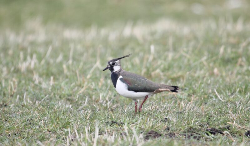
Potential restoration design for Tarland Burn up for discussion
A design for restoring the Tarland Burn is available for consultation
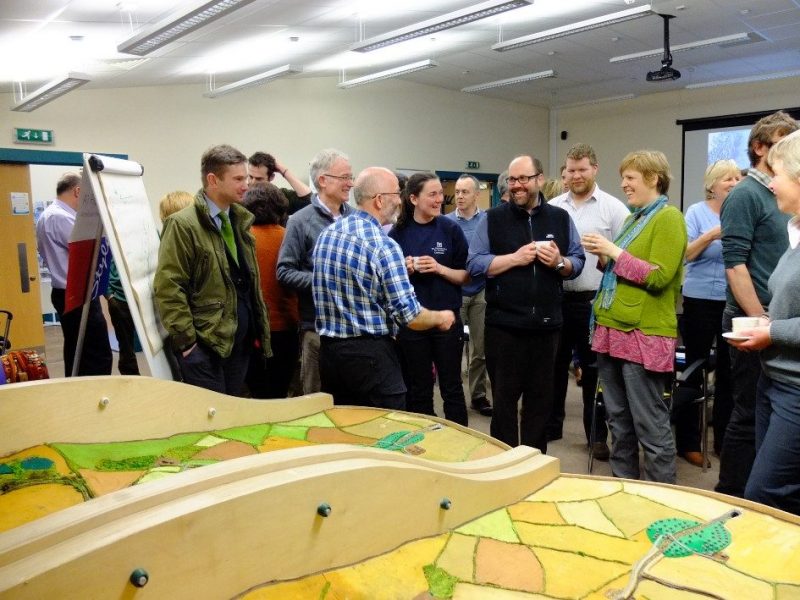
Tarland river restoration drop in event
A drop-in event about the ongoing restoration studies on the Tarland Burn is taking place on 30 March , 2pm – 8pm in the Upper […]
Funds secured to re-design Tarland burn for nature and climate resilience
The first step in restoring a degraded watercourse in Deeside has been given the green light thanks to an £84,000 funding boost from the Scottish […]